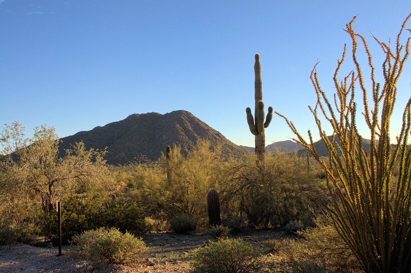
San Tan Regional Park
Consisting of over 10,000-acres, this southeast Valley park is a fine example of the lowland Sonoran Desert. For county listers, birders might note that this park is actually in Pinal County, despite being managed under the Maricopa County Parks system. The park ranges in elevation from about 1,400 feet to over 2,500 feet, over eight miles of trails for hiking, mountain biking and horseback riding. Park trails range in length from 1.1 miles to over 5 miles, and range in difficulty from easy to strenuous. The trails provide dramatic views of this desert mountain range and the surrounding valleys, with Goldmine Mountain is located in the northern area and the spectacular San Tan Mountain escarpment in the southern portion of the park. The vegetation changes from creosote flats to dense saguaro cactus forest. Various types of wildlife may be observed, with common birds including Gambel’s Quail, Western Screech-Owl, Gilded Flicker, Gila Woodpecker, Verdin, Cactus Wren, Curve-billed Thrasher, and Black-throated Sparrow. Bendire’s and Crissal Thrashers, and migrant songbirds may also be found in the lower bajadas with shrubby washes. The Nature Center offers educational tidbits, a small gift shop with souvenir items, and a desert tortoise exhibit. Restroom facilities are available and additional amenities are slated for future development.
If you are looking for an easy, relatively short hike, the Moonlight Trail is the perfect choice, as it provides a scenic and rather mild hike for all to enjoy. If you are looking for a longer more difficult hike, try the 5.1-mile San Tan Trail. This trail winds you through the Broken Lands and Central Valley portions of the park to the top of the Goldmine Mountains. In addition to its length, some may consider certain areas of the San Tan Trail difficult due to washes, soft soil and slick or rocky steep mountain slopes. We encourage hikers, mountain bikers and horseback riders to use extreme caution in these areas. Another visitor favorite is the Malpais Hills Trail as it displays a unique perspective of Rock Peak and the Malpais Hills. Don’t forget to keep an eye out for other wildlife such as javelinas, coyotes, and Gila monsters!
Site Information
Region: Phoenix and Central
County: Pinal
Directions: From central Phoenix, take I-10 east to US 60 east. Exit Ellsworth Road south to Hunt Highway. Travel east on Hunt Highway to Thompson Road south. Turn west on Phillips Road to the San Tan Mountain Regional Park entrance.
Latitude: 33.168349
Longitude: -111.63629
Operational Hours: Other
Other Operational Hours: May 1 to October 31: 5 am-9 pm daily. November 1 to April 30: 6 am-8 pm daily. Check the website for Nature Center hours.
Admission or Fees: $7 per vehicle. Maricopa County Parks annual passes also accepted.
Best time to visit: October-April, or early mornings May-September.
Habitats: Desert
Know Before You Go
The Nature Center is handicapped accessible, but the trails are not.
Safety First! Arizona has many beautiful places to explore and we’d like to help you make it a safe and enjoyable experience. Check out our recommendations for hiking precautions.
Species Highlights
Speciality: Bendire’s Thrasher, Costa’s Hummingbird, Gilded Flicker
Charismatic: Black-throated Sparrow, Cactus Wren, Curve-billed Thrasher, Gambel’s Quail, Gila Woodpecker, Greater Roadrunner, Verdin
Contact Information
Parks and Recreation Department
Maricopa County
41835 N Castle Hot Springs Rd
Morristown, AZ 85342
Phone: 602-506-2930
Website: https://www.maricopacountyparks.net/
Email: maricopacountyparks@maricopa.gov
Additional Resources
Learn more about birds reported at this location at eBird:
https://ebird.org/hotspot/L3576003


